According to NIFC, in 2018, a total of 8,054 wildfires occurred in California, which led to the burning of 1.8 million acres.
The 2019–2020 bushfire season in Australia caused the burning of over 46 million acres of forest while destroying over 10,000 structures.
The project intends to produce the Fire Forecasting capabilities using Deep Learning and develop further improvements in accuracy, geography, and time scale through the inclusion of additional variables or optimization of model architecture & hyperparameters to conserve and sustain forests for the future.
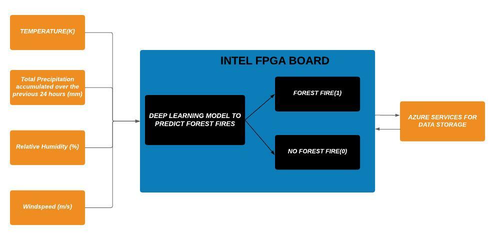
The data acquired from the sensors is processed by the Intel FPGA by the implemented Deep Learning Algorithm and is sent to the connected Azure-based cloud-server which will store real-time data of the factors and will transmit them to our model. The model will then analyze and produce results to be uploaded back to the cloud.
Project Proposal
1. High-level project introduction and performance expectation
a. Problem Statement
Wildfires have been immense in recent years causing severe damage to forests and possessing a threat to climate change and a sustainable future. The root cause of this is the delay and the inability to detect and stop forest fires at an early stage and a lot of natural resources are destroyed by the time measures are taken.
Wildfires are uncontrolled fires in the environment that can be caused by humans or nature. In 2020 alone, wildfires in California have burned 4.2 million acres, damaged 10,500 buildings or structures, and killed more than 31 people, exacerbated by climate change and a rise in average global temperatures. This also means there has been an increase in the costs of extinguishing these treacherous wildfires. The objective of the research is to detect forest fires in their earlier stages to prevent them from spreading, prevent them from causing damage to a variety of things, and most importantly, reduce or eliminate the chances of someone dying from a wildfire. A fire detection system should be efficient and accurate with respect to extinguishing wildfires in their earlier stages to prevent the spread of them along with their consequences.
b. Purpose of design
This project aims to detect and prevent occurrences of forest fires to reduce environmental impact and conserve our planet's resources. It collects the data of the area under observation through aerial means of monitoring (Drone/Loon based). It overcomes the limitations of current on-ground conventional methods as it reduces the threat of forest fires by giving the user a beforehand warning/alert about the area most prone to catching a forest fire based on the analysis of the influencing factors.
c. Why we used Intel FPGA devices
De10 Nano + Cloud Kit's features and characteristics are beneficial for the development of our model as running deep learning algorithms on Intel FPGAs massively reduces calculation time and reduces power consumption to a minimum by computing at the edge.
Thus achieving high real-time processing speed and good energy efficiency at a low cost. Also, upgrades and improvements can be done easily with its programmability and ability to reconfigure.
2. Block Diagram
3. Expected sustainability results, projected resource savings
Every year forest fires cause a lot of ecological imbalance and disrupt the natural habitat of wildlife. A lot of natural, monitory resources are wasted in controlling the spread of forest fires and extinguishing it. Moreover, it contributes to climate change and global warming.
This project aims at minimizing the utilization of the resources by predicting the wildfires and alerting the concerned authorities to take the necessary actions. Hence ensuring the sustainability of our natural resources.
In 2020, more than 58,250 wildfires occurred that burned nearly 10.3 million acres of land. Wildfire statistics show that these uncontrollable fires impact nearly 7.5 million acres of land every year, burning wildland vegetation in rural areas.
So there is an alarming need to do something about this problem and this is where our project integrated with INTEL FPGA comes to the rescue.
4. Design Introduction
For our hardware design specification the aim was to come up with something unique and novel, differing from current designs. Firstly, we wanted to avoid installation of sensors inside the forest on trees for collecting the four parameters namely temperature, wind speed, percipitation and relative humidity due to its four major drawbacks:
1) It is prone to being destroyed by the animals living in the forest.
2) It has limited scope with regards to area of coverage.
3) Manual Installation of the sensors will be very hectic.
4) Requirement of massive amount of hardware resources for large areas.
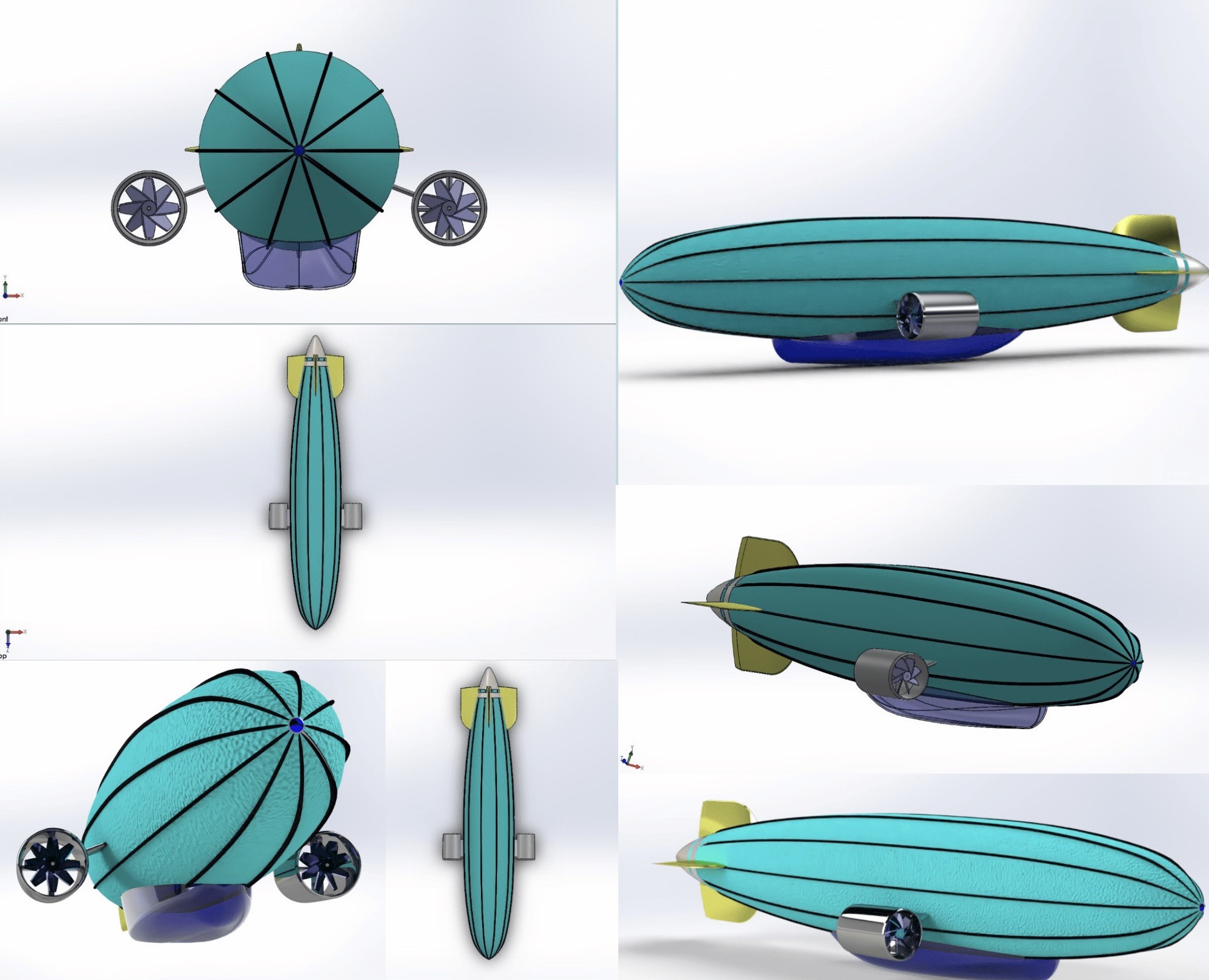
So, the idea was to implement a sort of aerial flying machine to mitigate the problem of area coverage but then a forest is a very huge land mass and a drone will have range barriers and less on-time due to its limited power source and increasing its range requires to invest a huge amount of capital. Therefore, after careful and considerate research we got inspired by Google X's wifi Loon balloon and the World War II famous bomb carrier Zepplin and thought of integrating these into our design.
We believe a simple and concise design is the best way of deriving a solution. The following points bring out the design aspects of our device:
1) Inside the zepplin, contains a simple heating element that will keep the air inside hot for it to float in air.
2) We will have a temperature monitor and a pressure sensor to control the vertical elevation of the loon.
3) In the case of too much pressure building up, a valve on the surface of the device will regulate the pressure inside by releasing the excess pressure.
4)In terms of horizontal area coverage we will set a circular region and continuously monitor the device location with gps tracker and if it is about to go out of the boundary we will push it back into the region of interest by using a simple mechanism.
Our design is different from the current employed system in the following ways:
1) By making a loon type structure we mitigated the whole range problem.
2) We made a small payload structure (Evident in the design) which will contain the fpga to read real time data from the sensors and upload to the azure cloud bucket.
3) It is less prone to be destroyed by animals.
5. Functional description and implementation
Since the problem addressed was a classification and prediction problem:
There was a thorough literature review done by the team to find the best possible solution.
The team majorly looked for papers for 3 major purpose:
i) To find an Efficient technique for data pre-processing to reduce noise
ii) To decide the algorithm to be used in the model.
iii) To find the best possible metric and loss function for the validation of the model.
DATASET EXTRACTION AND PREPARATION:
The dataset for training the forest fire prediction deep learning model was taken from the Call for code spot challenge for wildfires. The obtained dataset was provided with historical wildfires and both historical and forecast weather data.
The aforementioned dataset is available at this link:
Wildfire.csv
This wildfire data contains data on fire activities in Australia starting from 2005. It is based on MCD14DL (short name), which is the MODIS/Aqua+Terra Thermal Anomalies/Fire locations 1km FIRMS V006 NRT data product.
The data was spatially averaged to the following 7 regions/states in Australia
o NSW=New South Wales
o NT=Northern Territory
o QL=Queensland
o SA=Australia
o TA=Tasmania
o Vl=Victoria
o WA=Western Australia
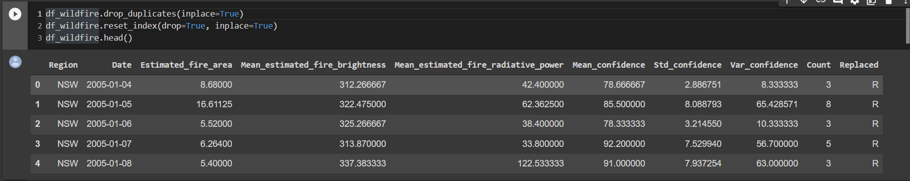
- Region: The 7 aforementioned regions for which data was aggregated
- Date: Day of acquisition of the data. All dates are in UTC and provides the data for 24 hours ahead
- Estimated fire area: Daily sum of estimated fire area for presumed vegetation fires with a confidence larger than 75% for a each region in km2
- Mean estimated fire brightness: Daily mean (by flagged fire pixels(=count)) of estimated fire brightness for presumed vegetation fires with a confidence level greater than 75% in Kelvin
- Mean estimated fire radiative power: Daily mean of estimated radiative power for presumed vegetation fires with a confidence level greater than 75% for a given region in Megawatts
- Mean confidence: Daily mean of confidence for presumed vegetation fires with a confidence level greater than 75%
- Std confidence: standard deviation of estimated fire radiative power in Megawatts
- Var confidence: Variance of estimated fire radiative power in Megawatts
- Count: Daily numbers of pixels for presumed vegetation fires with a confidence level of larger than 75% for a given region
- Replaced: Indicates with an Y whether the data has been replaced with standard quality data when they are available (usually with a 2-3 month lag). Replaced data has a slightly higher quality in terms of locations
HistoricalWeather.csv
The file contains daily aggregates computed from the hourly ERAS climate reanalysis. It contains all the information pertaining to Historical Weather data
All variables were aggregated to daily values from YYYY-mm-ddT01:00:00Z to YYYY-mm-(dd+1)T00:00:00Z
- Precipitation was derived from total precipitation. Hourly raw data is converted from m/hour to mm/hour
- Relative humidity is derived from the temperature and dewpoint. For each hourly timestamp, relative humidity is computed using the equation:
100*{EXP[(17.625*TD)/(243.04+TD)]/EXP[(17.625*T)/(243.04+T)]}
Here, TD is the dewpoint in degrees Celsius and T the temperature in the same unit. - Soil Water Content is given for 0 - 7 cm below the surface
- Solar Radiation or Surface Solar Radiation Downwards. Units are converted from J/h to MJ/h
- Temperature
- Wind Speed is calculated for every hour from the Easterly and Northerly 10 meter wind components.
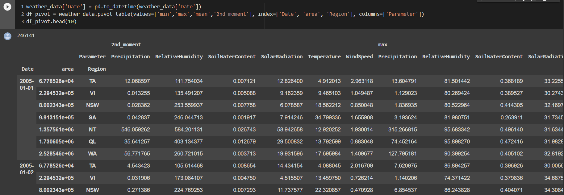
Precipitation, relative humidity, temperature and wind speed were the four parameters that were included for the model.
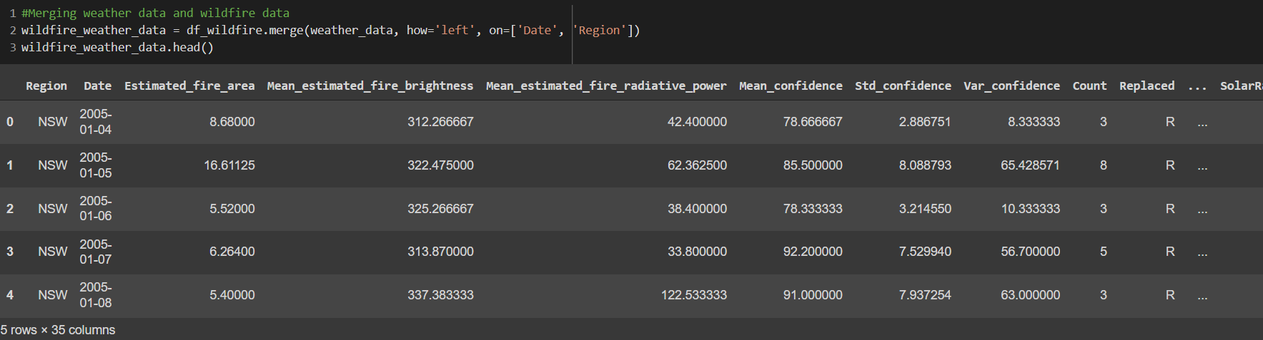
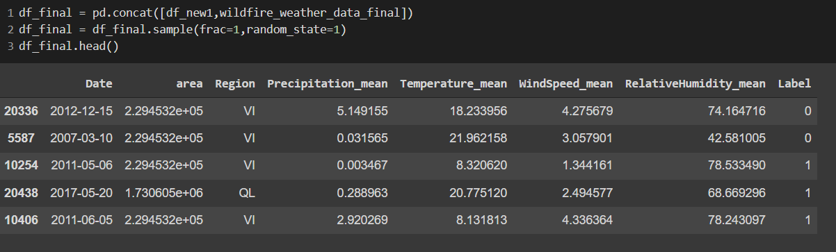
Merging Weather Data and Wildfire Data
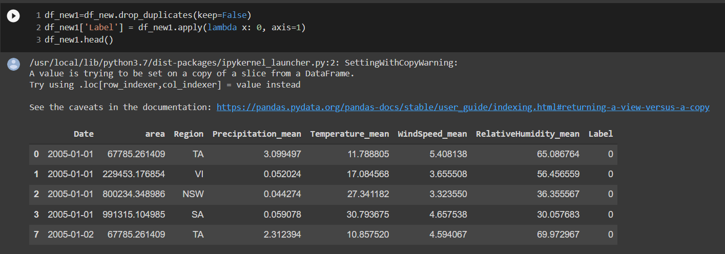
NON-WILDFIRE DATA WITH LABEL 0 (i.e. No Fire)
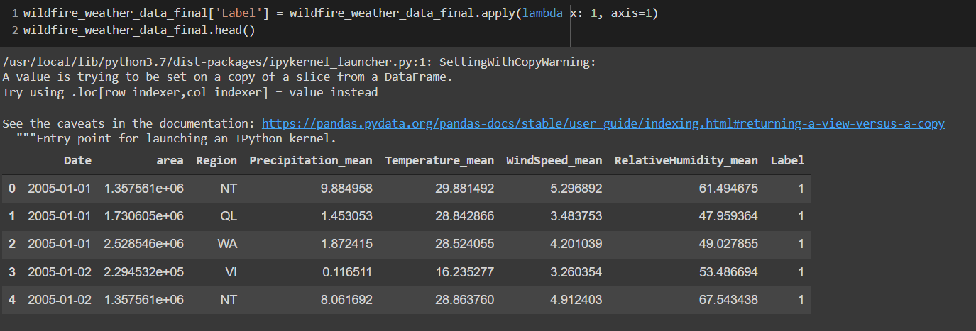
WILDFIRE DATA WITH LABEL 1 (i.e. FIRE)
FINAL DATASET WITH 4 DESIRED PARAMETERS AND LABEL 1 OR 0
After a brief review of the literature, some of the current state of the art models were implemented:
i) Decision Tree Classifer
ii) Random forest Classifier
iii) XG Boosted Gradient Tress
The performance metric for all the approaches are published in the upcoming section.
A design of collecting temperature and humidity from the RFS card is shown below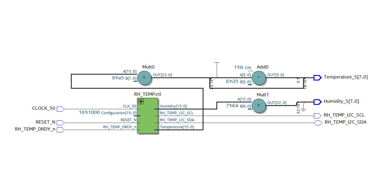
6. Performance metrics, performance to expectation
Model Implementation:
The various model architecture implemented and hyperparameters tuned:
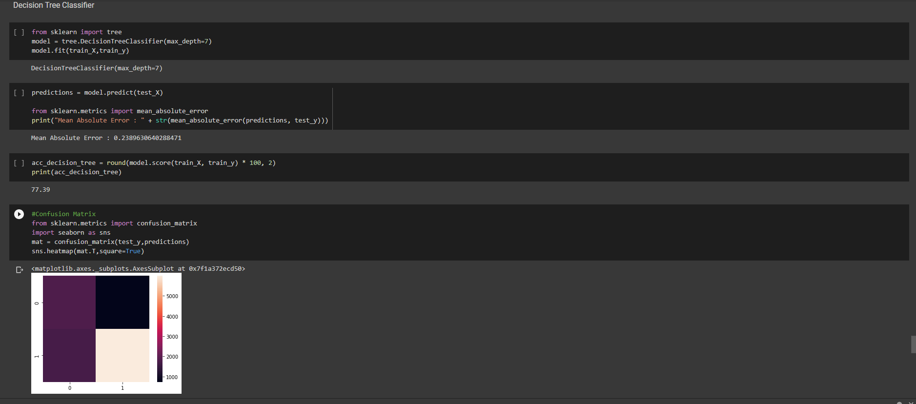
i) Decision Tree Classifier
Accuracy:77.39
Mean Absolute Error: 0.23
Max_depth of Tree: 7
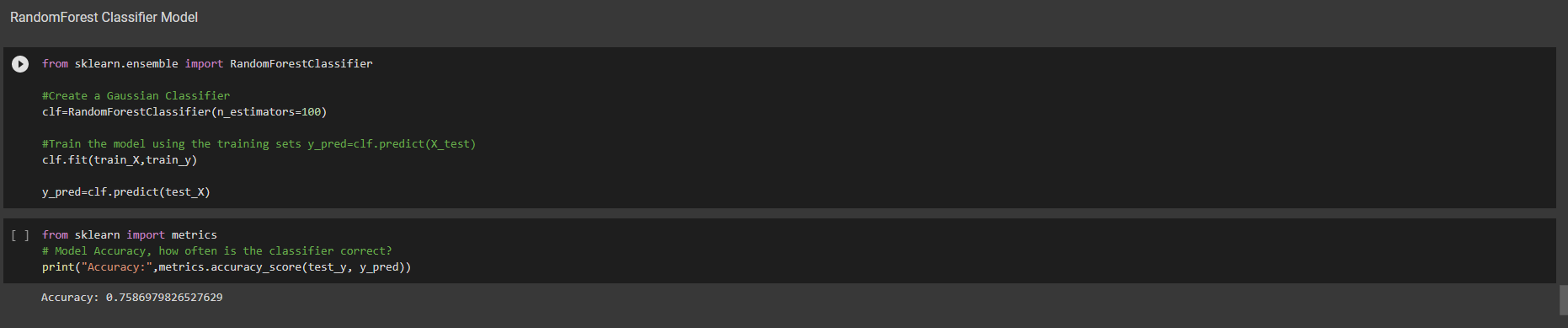
ii) Random Forest Classifier
Accuracy: 0.7586
n_estimators:100
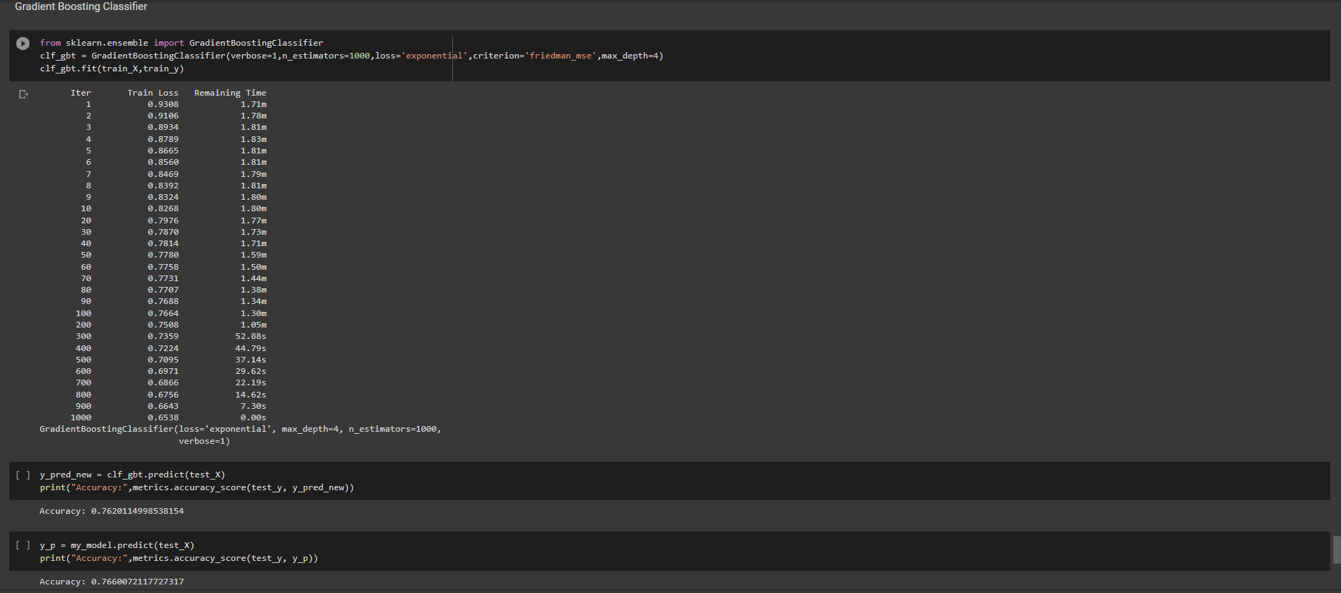
 iii)Gradient Boosting Classifier
n_estimators=1000
loss='exponential'
criterion='friedman_mse'
max_depth=4
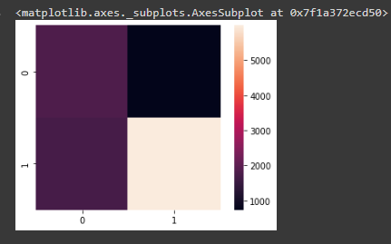
We used various Visualization and Explainable AI tools like Tensorboard and Confusion matrix to get a better understanding of the model working and tune the hyperparameters accordingly.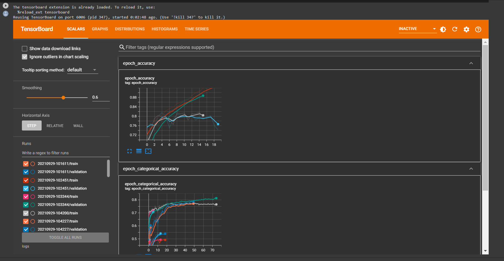
7. Sustainability results, resource savings achieved
- A robust system that helps in predicting the wildfires beforehand
- The proposed system is efficient with an accuracy of 77.39.
- The use of the DE10 Nano board makes the processing fast and cost-effective.
- The system helps to monitor the conditions before the wildfires inorder to take necessary actions.
- Wildfires are the cause for destruction of numerous natural resources and preventing them to some extent could help in preserving those resources.
- It helps in preventing the various environmental impacts due to wildfires.
8. Conclusion
- The implementation of a basic prediction of forest fires was done based on the needed aforementioned parameters.
- Various deep learning models were explored.
- Decision tree classifier had the highest accuracy compared to Random forest Classifier XG Boosted Gradient Tress.
0 Comments
Please login to post a comment.